Bain-Cline site at Trimble County

Discovering the Bain-Cline site at Trimble County

Before we begin major construction projects in new areas, our employees, contract partners and third-party consultants thoroughly review the area and do detailed analyses required by local, state and federal regulations. Among the regulations we follow is the National Historic Preservation Act of 1966.

In 2007, we began preliminary investigations on a portion of our Trimble County Generating Station property where we would construct a new dry storage facility as part of our long-term plans for managing materials, known as coal combustion residuals, left over after burning coal.

Early archeological investigations identified in a remote, steep-sided ravine northeast of the plant on what’s known today as the Bain-Cline Site (Site 15TM64), the remnants of a small late nineteenth-century tenant farmstead named after two landowners, Joseph Bain and Jane Cline.

Site designation

The site’s designation of “15TM64” means it’s located in Kentucky, which is number 15 in the alphabetical list of states, and it’s the 64th archeological site recorded in Trimble County, “TM.” This site has remained on private property since it was purchased by LG&E in 1988 and was not accessible to the public.

Bain-Cline aerial site location

This aerial photo shows the location of the Bain-Cline site, designated as 15TM64.

Data recovery plan prior to construction

Before construction began, a data recovery plan was developed and led in 2017 by third-party experts GAI Consultants on behalf of LG&E and in coordination with Kentucky Heritage Council and the U.S. Army Corps of Engineers. The plan made sure researchers were able to properly recover archeological artifacts from the site and analyze, catalog and report them — preserving pieces of the tenant farmer and sharecropper lifestyle found in Trimble County following the Civil War.   

After all recovery efforts

Since 2017 and after all recovery efforts were completed, we constructed our new dry storage facility, and it will be fully operational 2022. All recovered artifacts have been analyzed and are curated at the William S. Webb Museum of Anthropology in Lexington, KY. Archeological enthusiasts, teachers and students can learn more about the project, documented findings and the history of the Bain-Cline Site.

Full project details

The history of the Bain-Cline Site and its people

Deed research indicates that the landowners did not live on the property; instead, the farmstead was likely occupied by tenants. Artifact and documentary data suggest occupation by a lower socio-economic class with limited access to consumer goods—typical of many farmsteads from this period.

Bain-Cline site - patent proprietary

Artifacts found at the site included pieces of a patent medicine bottle embossed with “FEEN,” dated between 1800-1870. Visit the Findings tab to see more.

Recovered artifacts represent a thin scatter of trash (called “sheet midden”) found on the ground surface and in shallow soil deposits surrounding the former farmhouse. These artifacts indicate that occupants of the Bain-Cline Site lived a frugal life.

The ceramic fragments (sherds) that were recovered were mostly undecorated and were among the least expensive ceramics available at the time.

More expensive decorated ceramics (such as transfer print and shell-edged decorations) were few in number, suggesting the site occupants had limited financial ability to acquire these consumer goods. Ceramic artifacts also included large numbers of holloware forms (bowls, cups) versus flatware (plates). The concentration of holloware may indicate that the household lived on soups and stews comprised of bones and less expensive cuts of meat.

The earliest evidence of property ownership is an 1861 deed between John A. Bain and Jane C. Cline, which describes the property as the “old farm of W.A. Moreland”, referring to Walter Alexander Moreland.

John A. Bain and Jane C. Cline

This is a photo of John A. Bain and his second wife, Mary E. Irwin. Source: Ancestry.com

Timeline

  • Walter A. Moreland (died 1855) moved to present-day Trimble County with his father, William, around 1823. William Moreland (1768-1826), originally a plantation owner from Maryland, moved his family westward, first to Virginia and then to Kentucky. At his death in 1826, William Moreland owned approximately 400 acres of land along the Ohio River and willed 80 acres to his son, Walter. By 1837, tax records indicate that Walter A. Moreland owned 350 acres of land. The 1840 U.S. Census listed Moreland as owning 15 slaves, while the 1850 census records listed his occupation as a farmer. Moreland is also recorded in the 1847 Kentucky State Register as a Justice of the Peace for Trimble County.
  • The subsequent owner of the property was John A. Bain (1824-1891), who, in 1841, married Mary Ellen Moreland, one of Walter Moreland’s daughters. Tax records indicate that ownership of the property likely passed from Walter Moreland to Bain and Mary Ellen prior to 1845. The 1845 tax records recorded John Bain as owning 250 acres near Corn Creek. The household included one white male over 21 years of age, along with two slaves. The 1860 census records list Bain’s occupation as a minister and farmer. By this date his property had decreased to 175 acres, and he was still listed as the only white male over 21 in the household, along with two children and six slaves. John’s wife, Mary Ellen Moreland Bain, died in 1855 and the next year he married Mary E. (see photograph).
  • In 1861, Bain sold 85 acres of his property, described as the “old farm of W.A. Moreland,” to Jane Cline, the remarried widow (third wife) of Walter A. Moreland. The 1860 census lists Jane C. Cline as living in Carrollton, Carroll County, Kentucky, with her husband, John G. (a ship boat captain) and their children. Despite the purchase of the Trimble County property in 1861, 1870 census records show that the Cline family continued to reside in Carrollton. Jane died circa 1887 and she willed her land in Trimble County to her daughter, Jennie Moreland Jett.
  • No evidence was uncovered indicating that either Jane Cline or Jennie Jett and her husband, George, ever resided on the Trimble County property. The 1900 U.S. Census lists the Jett family as living in Carrollton, where George worked as a distiller. After her husband’s death, Jennie Jett lived in Carrollton with a lodger and companion, named Dora Lee Browning (Adams). At her death in 1942, Jennie Jett willed her land in Trimble County to Dora Lee Browning.
  • When Dora Lee Browning died in 1947, the Trimble County land was passed to her daughter, who also lived in Carrollton. During the second half of the twentieth century, the 87-acre parcel in Trimble County passed through several additional owners, prior to its purchase by LG&E in 1988.

To learn more about this project and other related topics, check out “Archaeological Investigation of the Bain-Cline Site,” developed by GAI Consultants, in the Classroom Materials tab.

About the archeological investigations and findings

Recovered artifacts and documentary research indicated that the Bain-Cline Site represented a nineteenth-century farmstead. Further archaeological investigations were recommended to evaluate the site’s importance, including its eligibility for listing in the National Register of Historic Places (NRHP).

In 2008, subsequent archaeological testing of the site was conducted. Excavations produced over 300 period artifacts and confirmed the presence of intact construction features (chimney remains, remnant fieldstone retaining wall).

Documentary research indicated that the landowners did not live at the site and the residents of the farmstead were likely tenants, renters, or wage earners. Based on the results of the archaeological study, the Kentucky Heritage Council agreed that the site was NRHP eligible. 

2017 Archaeological Investigations

Additional excavations were conducted in March and April 2017 to gather important archaeological data prior to potential site impacts. Fieldwork included the systematic excavation of test pits and test squares using shovels and trowels, with soils passed through narrow mesh screens to recover artifacts.

These hand excavations were followed by mechanical (backhoe) stripping of topsoil to search for cultural features (i.e., soil stains or structural remains) representing evidence of site occupation. These investigations exposed three cultural features and recovered over 1,900 historic-period artifacts.

Features

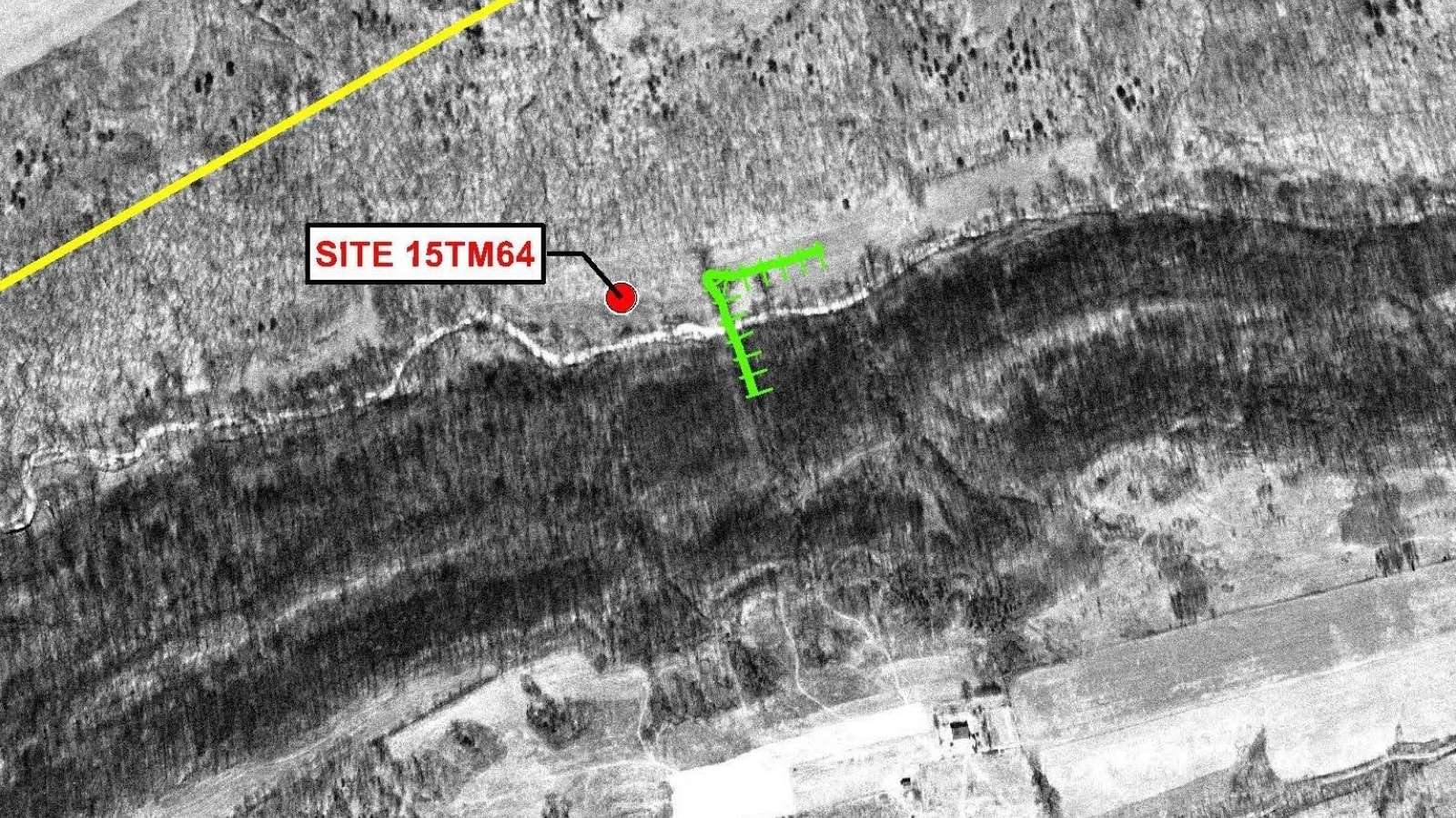
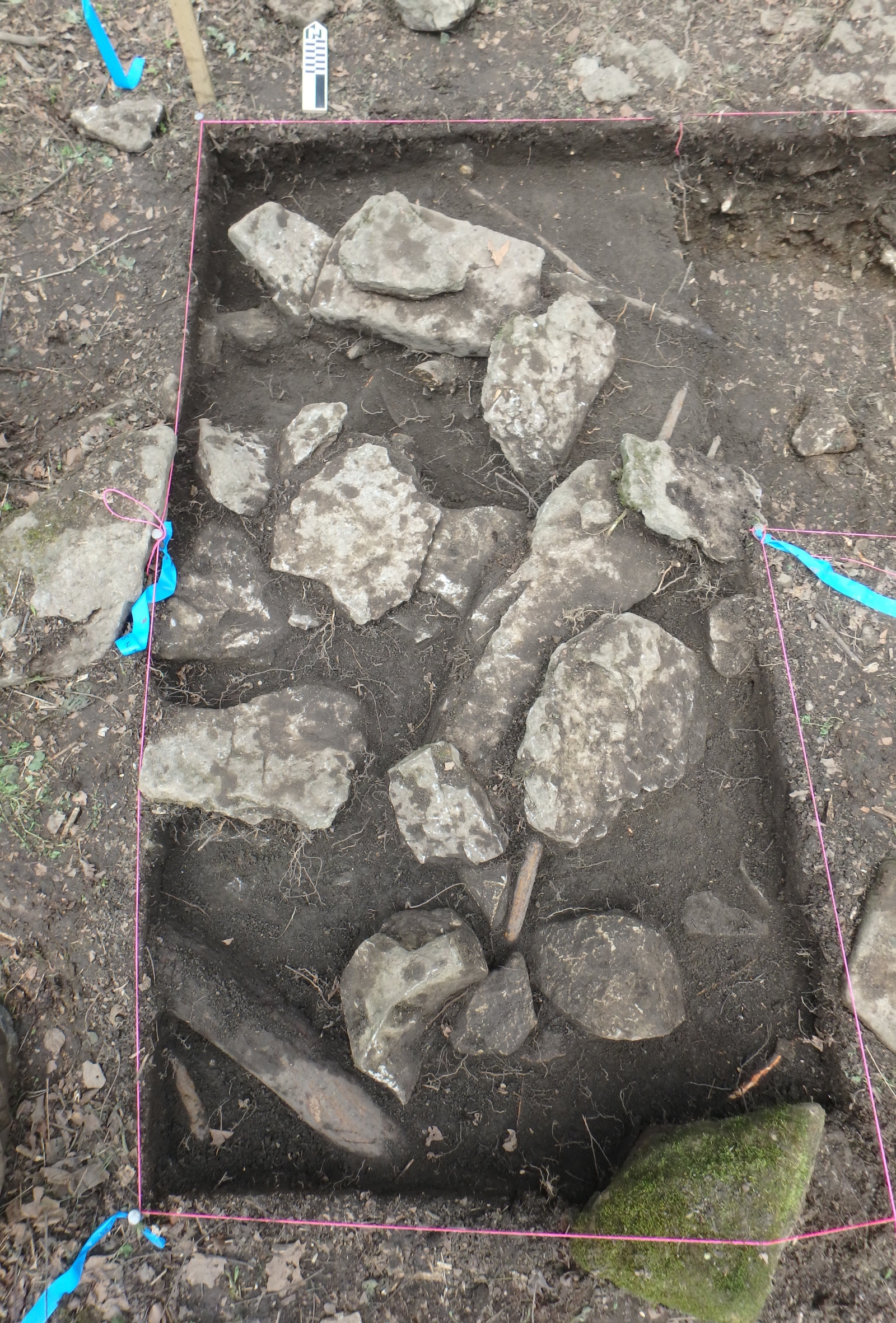
The three cultural features included the previously-identified collapsed chimney remains—the only architectural feature found at the site, as well as two ash and charcoal lenses—one representing the underlying base of the hearth (fire box) and one interpreted as a nearby episode of chimney clean-out. The chimney remains mark the location of the former farmhouse.

This feature consists of a concentration of flagstones made of limestone. The flagstones do not appear to be in intact courses, suggesting that the chimney may have collapsed slowly over time rather than all at once.

Artifacts

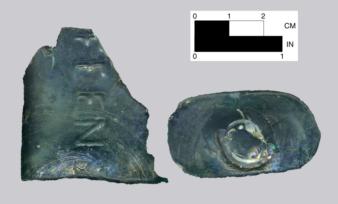
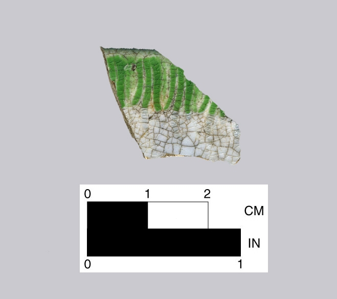
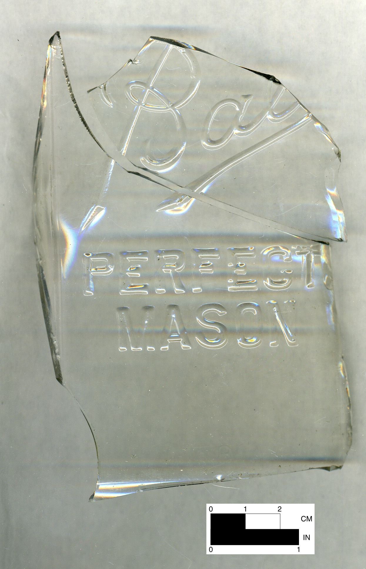
Excavations produced over 1,900 historic-period artifacts (a relatively small number for such a site), with most consisting of small, fragmentary specimens. (Each individual fragment of material that provides evidence of human use is considered an artifact during the investigation.) The bulk of the artifacts were found in the vicinity of the former farmhouse, with a smaller concentration occurring near a barbed wire fence east of the structure. The recovered artifacts consisted largely of kitchen-related items and architectural debris, typical for farmstead sites. The kitchen artifacts included broken pieces of ceramic dishes and crocks (called “sherds”), fragments of glass bottles and jars, and a few utensil parts.

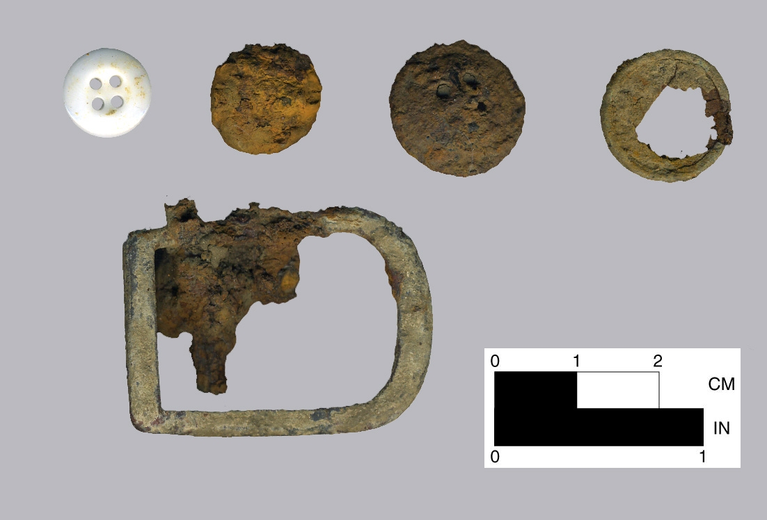
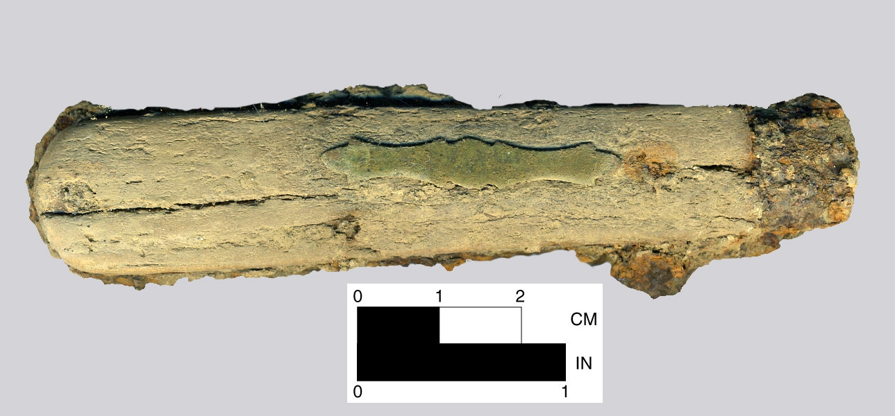
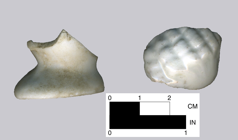
Architectural debris included nails and small amounts of mortar, brick, and window glass. The remainder of the items included pharmaceutical bottles, lamp glass, buttons, a glass bead, belt buckle, porcelain doll fragments, shotgun shell, pocket knife, and stoneware smoking pipe fragments.

All recovered artifacts have been analyzed and are curated at the William S. Webb Museum of Anthropology in Lexington, KY.

To learn more about this project and other related topics, check out “Archaeological Investigation of the Bain-Cline Site,” developed by GAI Consultants, in the Classroom Materials tab.

Bain-Cline chimney

Stone pieces of a chimney marked the remnants of the former farmhouse.

Buttons and buckle
Knife
Porcelain doll heads

Artifacts found at the site included kitchen-related items and architectural debris, typical for farmstead sites. Buttons and belt buckle; green shell-edge pearlware decorated ceramics, dated between 1780-1830; folding pocketknife with a bone handle and shield; a canning jar embossed with “Ball” and “PERFECT MASON,” dated between 1880-1922; and fragments of a porcelain doll.

Green pearlware
Mason jar

Classroom materials

For teachers and students who’d like to learn more about this project and other related topics, check out “Archaeological Investigation of the Bain-Cline Site,” developed by GAI Consultants. In this PDF document, learn more about how farming in the southern United States evolved during the Reconstruction Period following the American Civil War. This curriculum meets Kentucky Academic Standards for Social Studies, and includes a quiz and answer key at the end.

Background

  • Applicability: Kentucky Academic Standards for Social Studies
  • Grade 8: The United States: 1600-1877
  • Discipline Strand Key: Civics, Economics, Geography and History
  • Time Period:   Postbellum Period in Kentucky 1861-1865. Reconstruction Period 1865-1877
  • Topics: This lesson could be used to supplement units relating to the life and culture of tenant farmers in Kentucky and southeastern U.S., archaeology, history, lifeways, and land use.